 From the US National Weather Service in Paducah:
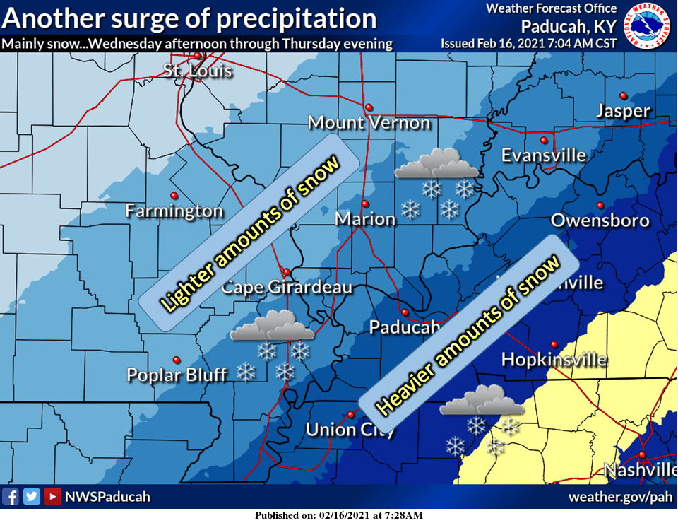
After a brief reduction or lull in the precipitation Wednesday afternoon, yet another surge of wintry precipitation is forecast to arrive Wednesday night and linger into Thursday. The system could bring significant amounts of wintry precipitation to parts of the region. The primary precipitation type appears to be snow, but some freezing rain is possible. Stay tuned to the forecast as we try to narrow down the main axis of heavier precipitation over the next 24 hrs.