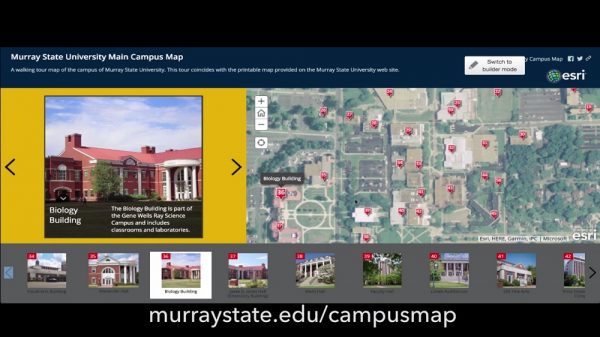
Murray State University’s department of geosciences and office of branding, marketing and communication have partnered on the development of a new online campus map. The map, which lists more than 60 campus buildings and areas through modern mapping technology, serves as a valuable walking tour of Murray State’s campus. The map is available at murraystate.edu/campusmap.
The conceptual idea began in August 2016 as the two units met to discuss the goal of developing a more efficient and mobile-friendly campus map. An online campus mapping application afforded geosciences faculty member Michael Busby, along with Travis West, a geosciences/geographic information sciences major from Somerset, the opportunity to lead the project and develop the map, which includes photos and descriptions of various campus locations.
The result is a responsive and interactive campus map that served as an experiential learning project for West, under Busby’s guidance.
“It’s fantastic to have an environment that is conducive to allowing students to develop skill sets they are learning in the classroom,” said Busby. “It’s great when you have support from campus administrators who recognize the potential and also see that students are benefiting from this.”
“Understanding the world around you is the first step to positively impacting it,” said West. “I’m glad I’ve had the opportunity to contribute to people’s understanding and familiarity of campus through this project.”