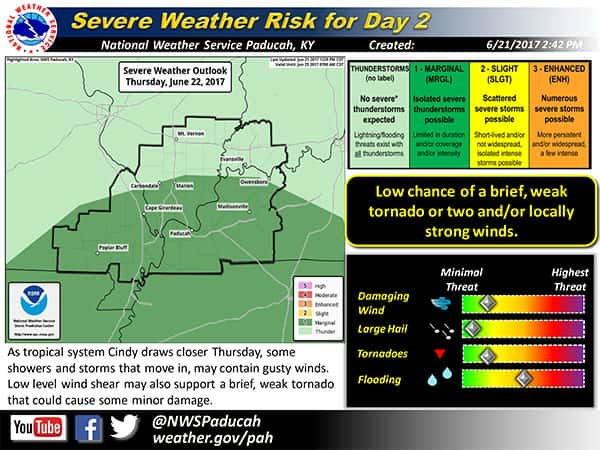
The National Weather Service in Paducah is warning residents of the potential for heavy rainfall and flash flooding, as moisture from Tropical Storm Cindy tracks through the area.
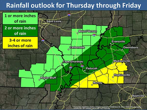
According to NWS, moisture streaming north from the storm combined with a cold front moving east later this week will “enhance rainfall” across the south, and into the Midwest. Heaviest rainfall totals in western Kentucky are expected Thursday and Friday. Forecasters expect 2-4 inches across the region.
A few strong thunderstorms are expected, with locally higher rainfall totals possible in persistent storms. Flooding problems could develop, particularly in western Kentucky, where the ground is already moist from heavy rains last weekend. Residents are urged to exercise caution when traveling
Isolated, weak tornadoes are also possible across the region Thursday afternoon and evening. However, primary concerns will be rain and lightning, according to NWS forecasters.
Heavy rain and thunderstorms are expected to end Friday night. Forecasters say dry weather should come on the heels of Cindy, with cooler than normal temperatures and humidity levels likely throughout the weekend.