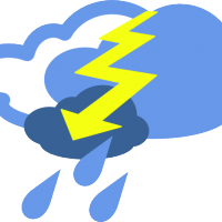
Severe storms may be cause for concern in Marshall County and surrounding western Kentucky this weekend.
Meteorologists with the National Weather Service have predicted a break in the rain this afternoon may follow with scattered severe thunderstorms through the area beginning about 9 p.m. tonight. The greatest risk of thunderstorms will extent through about 4 a.m.
NWS forecasters say large hail and damaging wind gusts would likely be the greatest hazards associated with this weather system, however isolated tornadoes were still a possibility.
The potential for heavy rainfall – particularly in southeast Missouri and southern Illinois – could pose a flash flooding risk. However that risk diminishes in west Kentucky, where rainfall is expected to be lighter than the 3-5 inches expected this weekend in surrounding regions.
Residents could see the severe weather potential continue into Sunday. NWS forecasts say another round of strong to severe storms will be possible Sunday afternoon and evening, again bringing the possibility of large hail and damaging wind gusts. Flash flooding and isolated tornadoes may also accompany this system.
While conditions are expected to be cooler and drier through the beginning of the work week, another round of thunderstorms could develop early Wednesday in the area. While NWS meteorologists did not anticipate Wednesday’s storms to be severe as of Saturday, more heavy rainfall could cause flooding.
For more information on expected weather conditions, visit www.weather.gov.